CV
Publications
Projects
Lectures
Research
Locations
Miscellaneous
Links
Events
News
Contact
e-SOTER Project General Assembly, Morocco 2011
Research
areas: Germany, Laos, Thailand, VietnamExcursions: Australia, China, Germany, Hungary, Morocco, Thailand (NE-part)
Date: October 04 - October 07, 2011
Brief introduction
The eSOTER field trip went from Rabat to the Kariat Ba Mohamed region and the Taza-Tahla region. The Kariat Ba Mohamed region is part of the Pre-Rif domain. The Taza-Tahla region straddles three geological units: the Fes-Taza couloir, the Rif and the Middle Atlas.
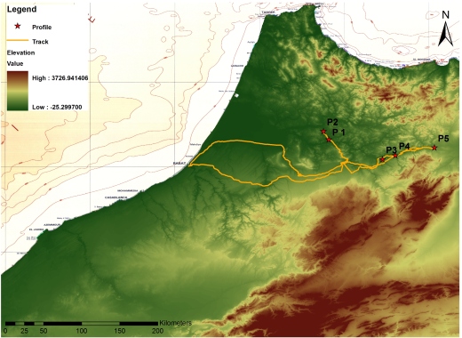
Figure 1: Field trip route and visited soil profiles in the Moroccan e-SOTER window.
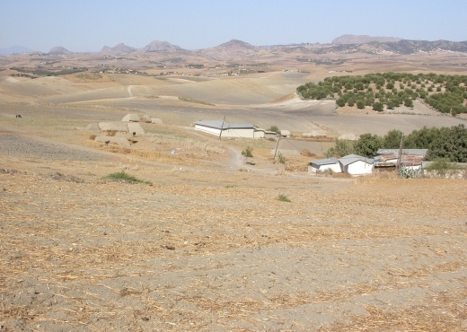
Kariat Ba Mohamed region
The Kariat Ba Mohamed region is part of the Pre-Rif domain. It is a group of complex geological formations, mostly Cretaceous and Tortonian marly series. The complexity of the region results from an extreme disorder of different sedimentary formations' laying and from thrust and chip structure, knowing that the Pre-Rif domain experienced the same orogenic phases as the Rif mountain domain. Generally, the Rif mountain domain is a part of the Mediterranean Alpine orogeny which results from the rapprochement of the European and African plates. The climate is Mediterranean semi-arid in the South, with a slight tendency to sub-humid climate in the North. Average annual rainfall ranges between 500 mm and 600 mm with a slight North-South gradient. The mean monthly temperature is about 12°C, the mean minimum is about 5°C (during winter) and the mean maximum is about 39°C (during summer). The average annual evapotranspiration is 1500 mm with a maximal value of 230 mm in July.
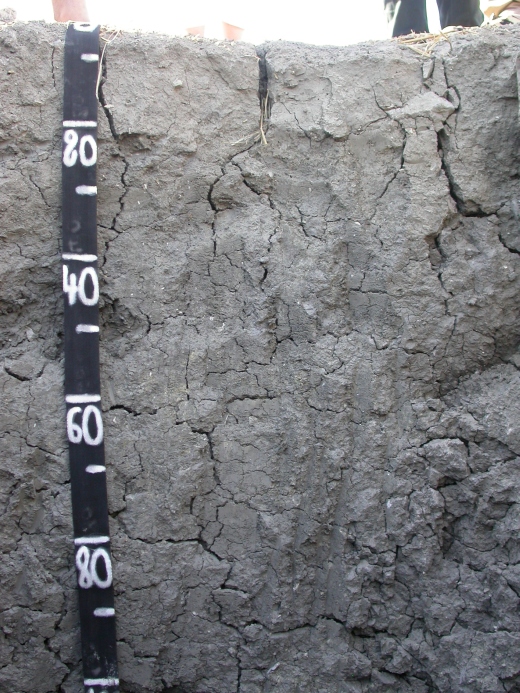
Profile 1
Soil type: Grumic, Calcic Vertisol (Eutric, Pellic)
Parent rock: marlstone (Triassic)
Position: N34° 19' 40.5'' W05° 10' 59.7''; Elevation: 117 m asl
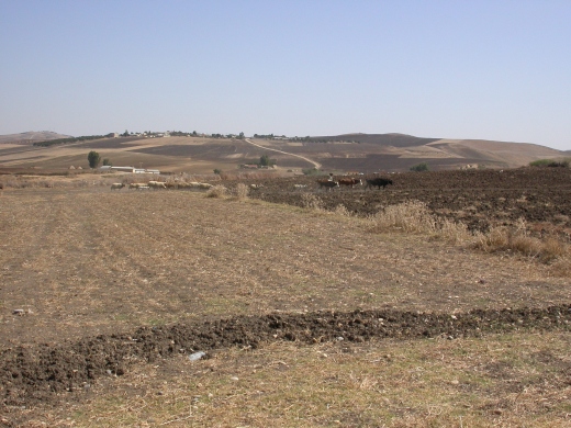
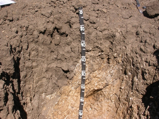
Figure 1: Vertisol landscape (left), soil
profile of a Vertisol from marlstone, showing different subsurface
features (right).
The visited Vertisol profile contained different subsurface features, which are bounded by major slickensides. The bright subsoil material of the right corner is part of a "chimney", whereas the part of the left side grades into a "bowl". During a period of swelling, soil material in the section of the "chimney" soil material is mainly pushed upwards, while in the section of the "bowl" lateral shear stress prevails. During dry season, the smectite-rich soil material is affected by shrinking, leading to deep and wide cracks.Generally, Vertisols occur at lower landscape position. Towards higher landscape positions Vertisols increasingly integrate with Cambisols and Regosols.
Profile 2
Soil type: Vertic Cambisol (Calcaric, Eutric)
Parent rock: marlstone (Paleocene)
Position: N34° 25' 29.4'' W05° 14' 43.5''; Elevation: 178 m asl
 |
 |
 |
Taza-Tahla region
The Taza-Tahla region straddles three geological units: the Fes-Taza couloir, the Rif and the Middle Atlas. The Fes-Taza couloir is part of the south Rif couloir that extends from the Atlantic Ocean to the Mediterranean Sea. It contains Miocene marls and some recent to ancient Quaternary deposits. The Rif unit takes place in the north of the couloir where the first Rif hills occur and constitute the marly pre-Rif zone. This marl zone lies as the foreland of the autochthonous Rif and holds several facies: Trias with white to reddish gypsum masses, Jurassic with flysch units, Early Cretaceous with sedimentary klippes, Late Cretaceous with homogeneous (trey-light blue) or motley (dark grey, light grey and red) marls, Eocene with chert bearing white marls, Oligocene with light marls, Low and Middle Miocene with marly lime and Late Tortonian with sandstone, conglomerate and marls. The Tortonian also occurs as a marly matrix called "Rif complex". The third geological unit of the Taza-Tahla region unit is a part of the Middle Atlas and it is divided into two sub-domains. The first one is the Middle Atlas causse, it is a tabular structure with Lias limestones. The second one is the pleated Middle Atlas, it is a succession of broken anticlinal ridges separated by large synclines.
The climate of this region is highly variable, tending to aridity in the East due to exposition, while the altitude is the influencing factor in the Pre-Rif. Average annual rainfall varies strongly from year to year, ranging from 199 mm to 1485 mm. Temperature is at its maximum in July and august, reaching 40°C, and at its minimum between December and February, reaching 5°C. Blanney-Criddle evaportranspiration varies from 849 mm a-1 to 1559 mm a-1 with maxima in July and minima in December. Insolation is 3000 h a-1 and dominant winds are oriented either east-west or following the Inaouen valley.
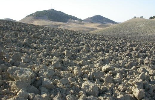
Profile 3
Soil type: Calcic Kastanozem (Clayic, Chromic)
Parent rock: gravel (Quaternary) over marlstone (Miocene)
Position: N34° 05' 38.4'' W04° 32' 52.5''; Elevation: 325 m asl
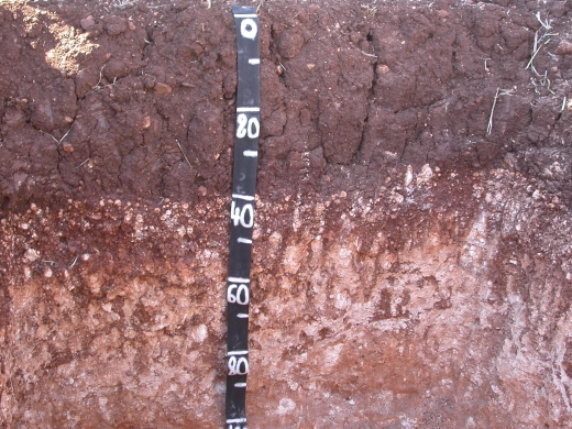
Figure 3: Location of soil profile on a former river terrace (right). Soil profile of a Kastanozem from gravel and marlstone.
Profile 4
Soil type: Calcic Kastanozem (Endoskeletic, Clayic, Chromic)
Parent rock: gravel (Quaternary) over limestone (Miocene)
Position: N34° 08' 26.5'' W04° 23' 42.7''
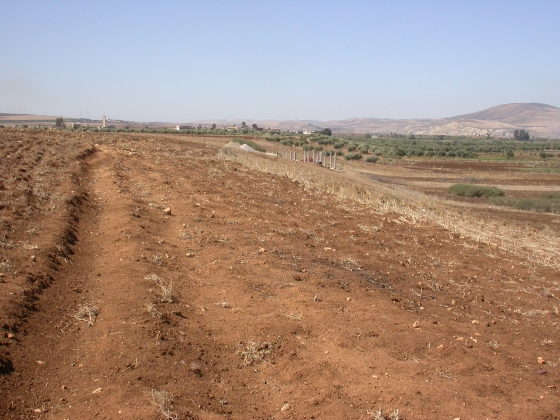
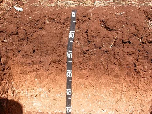
Figure 4: Former river terrace with Kastanozems. Soil profile of a Kastanozem from gravel.
Profile 5
Soil type: Humic Calcisol
Parent rock: conglomerate (Miocene)
Position: N34° 13' 54.4'' W03° 56' 02.8''
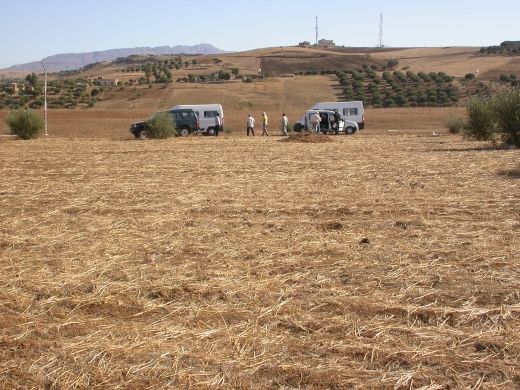
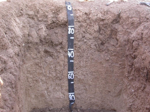
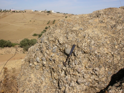
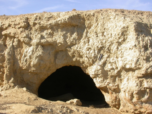
Figure 5: Calcisol landscape (top left), soil profile of a Calcisol from conglomerate (top right), conglomerate outcrop on a slope below a plateau with Calcisols (bottom left), sheep shelter within the Calcic horizon (bottom right).
References
Geological Map of Morocco at 1:1M scale.
Moussadek, R., Iaaich, H., Zouahri, A., Douaik, A., El Ouadi, M., 2011. eSOTER Project General Assembly. Morocco, 2011 October 4th-7th. Field book. Research Unit.